
Matakana traffic updates consistently identify the Hill Street intersection in Warkworth as the primary congestion point for travelers. To avoid significant delays, utilize real-time navigation apps like Waze, consider the alternative State Highway 16 route during peak holiday periods, and plan departures from Auckland before 2:00 PM on Fridays or after 10:00 AM on weekends.
Matakana is one of New Zealand’s premier destinations for marine education, boutique tourism, and weekend getaways. However, its popularity often outstrips the capacity of the roading infrastructure connecting it to Auckland. Whether you are heading up for a visit to the Goat Island Marine Discovery Centre or the famous Saturday markets, understanding the traffic patterns is crucial for a stress-free journey. This guide provides authoritative strategies to navigate the congestion.
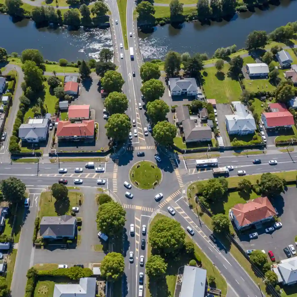
What is the Hill Street Intersection and Why is it a Bottleneck?
The Hill Street intersection in Warkworth is widely regarded as one of the most complex and congested intersections in the Auckland region. It acts as the gateway to the Matakana Coast, effectively funneling traffic from State Highway 1 (and now the new motorway terminus) into the local roads leading to Matakana, Omaha, and Leigh.
Despite recent roading upgrades in the wider region, this specific intersection remains a critical choke point. It is a multi-legged intersection that manages traffic flow from:
- State Highway 1 (North and South)
- Matakana Road (East towards the coast)
- Hill Street (Local traffic)
- Elizabeth Street
- Sandspit Road
Because five distinct traffic sources converge here, signal phasing is long, and queues can build rapidly. During peak summer periods and long weekends, delays at this single intersection can add 30 to 60 minutes to travel time. Understanding lane discipline here is vital; getting in the wrong lane can force you back onto SH1 when you intended to turn onto Matakana Road.
When are the Best Times to Leave Auckland for Matakana?
Timing your departure is the single most effective traffic avoidance strategy. Analyzing historical traffic data and local patterns reveals distinct windows of opportunity that can save hours of travel time.
Friday Departure Strategy
The “weekend exodus” is a well-documented phenomenon. Traffic volume on SH1 northbound begins to swell significantly earlier than traditional rush hour.
- The Danger Zone: 3:00 PM to 6:30 PM. During this window, commuter traffic mixes with holiday traffic. The new Ara Tūhono motorway helps, but it often shifts the bottleneck further north or causes congestion where the motorway merges with local roads.
- The Sweet Spot: Departing before 1:00 PM is ideal. If work commitments make this impossible, waiting until after 7:30 PM is often a smarter move than sitting in gridlock.
Saturday and Sunday Patterns
Saturday mornings are notorious for the “Market Run.” The Matakana Farmers’ Market opens at 8:00 AM, driving a surge of traffic.
- Saturday Morning: Traffic peaks between 9:00 AM and 11:00 AM. To beat the rush, aim to pass the Johnstones Hill Tunnels before 8:30 AM.
- Sunday Return: The return journey south to Auckland is often the most painful leg of the trip. Congestion typically builds from 11:30 AM and stays heavy until 5:00 PM. Leaving Matakana after dinner (around 6:30 PM or 7:00 PM) usually guarantees a clear run.
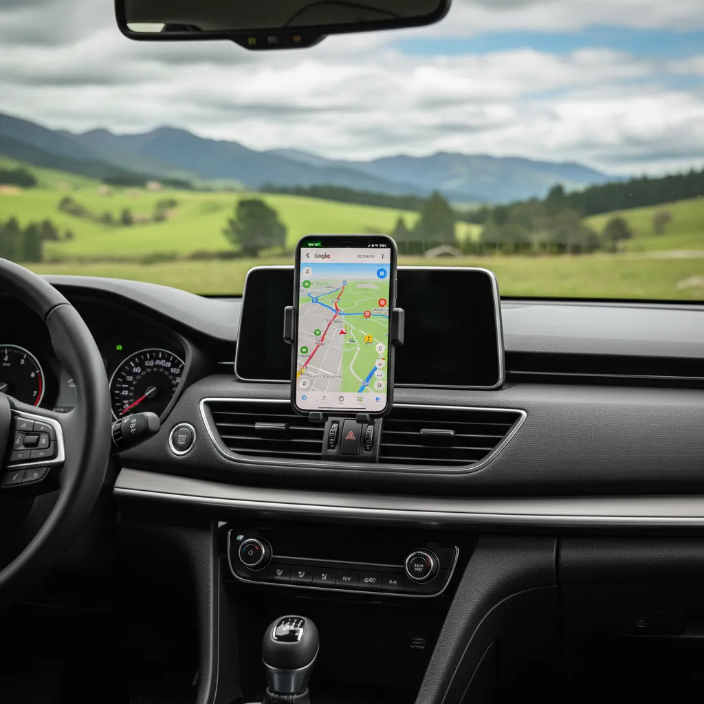
Should You Use Google Maps or Waze for NZ Traffic?
While both applications are owned by Google, their utility differs significantly when navigating New Zealand’s rural-coastal road networks.
Google Maps is generally superior for lane guidance and general estimated times of arrival (ETA). It tends to be more conservative, keeping you on main highways (SH1) unless a major blockage occurs. For drivers unfamiliar with the winding back roads of Rodney, Google Maps is the safer choice.
Waze, however, is aggressive in finding time-saving detours. It relies heavily on user-generated reports. In the context of Matakana traffic updates, Waze shines by:
- Identifying Police Presence: Highlighting speed traps or enforcement zones on the open road.
- Suggesting Back Roads: Waze is more likely to route you through Old North Road or other rural bypasses to avoid the Warkworth jam.
- Real-Time Hazard Alerts: Debris on the road or stopped cars are reported faster on Waze.
Verdict: Run Waze in the background for alerts, but use Google Maps for visual navigation if you are towing a boat or caravan, as Waze detours can sometimes lead to unsealed or narrow roads unsuitable for large vehicles.
How to Use the SH16 Alternative Route
When State Highway 1 is gridlocked—often caused by an accident near the tunnels or heavy congestion at the Pūhoi merge—State Highway 16 (SH16) becomes the primary alternative.
The West Coast Route
This route takes you from Auckland via Kumeū, Helensville, and Kaukapakapa, eventually cutting back towards Warkworth via West Coast Road or Kaipara Flats Road.
Pros:
It is a moving queue rather than a standstill. The scenery is rural and pleasant. It completely bypasses the Johnstones Hill Tunnels and the Pūhoi area.
Cons:
It is physically longer in distance. The road is winding and has fewer passing lanes. If you get stuck behind a slow truck or a tractor, your travel time can balloon.
When to Commit to SH16
Check your navigation app before you leave your driveway. If the ETA on SH1 is showing more than 90 minutes from the CBD to Warkworth (normally a 45-55 minute drive in clear traffic), SH16 is likely the better option. Once you pass the SH16/SH18 interchange in Westgate, you are committed, so make the decision early.
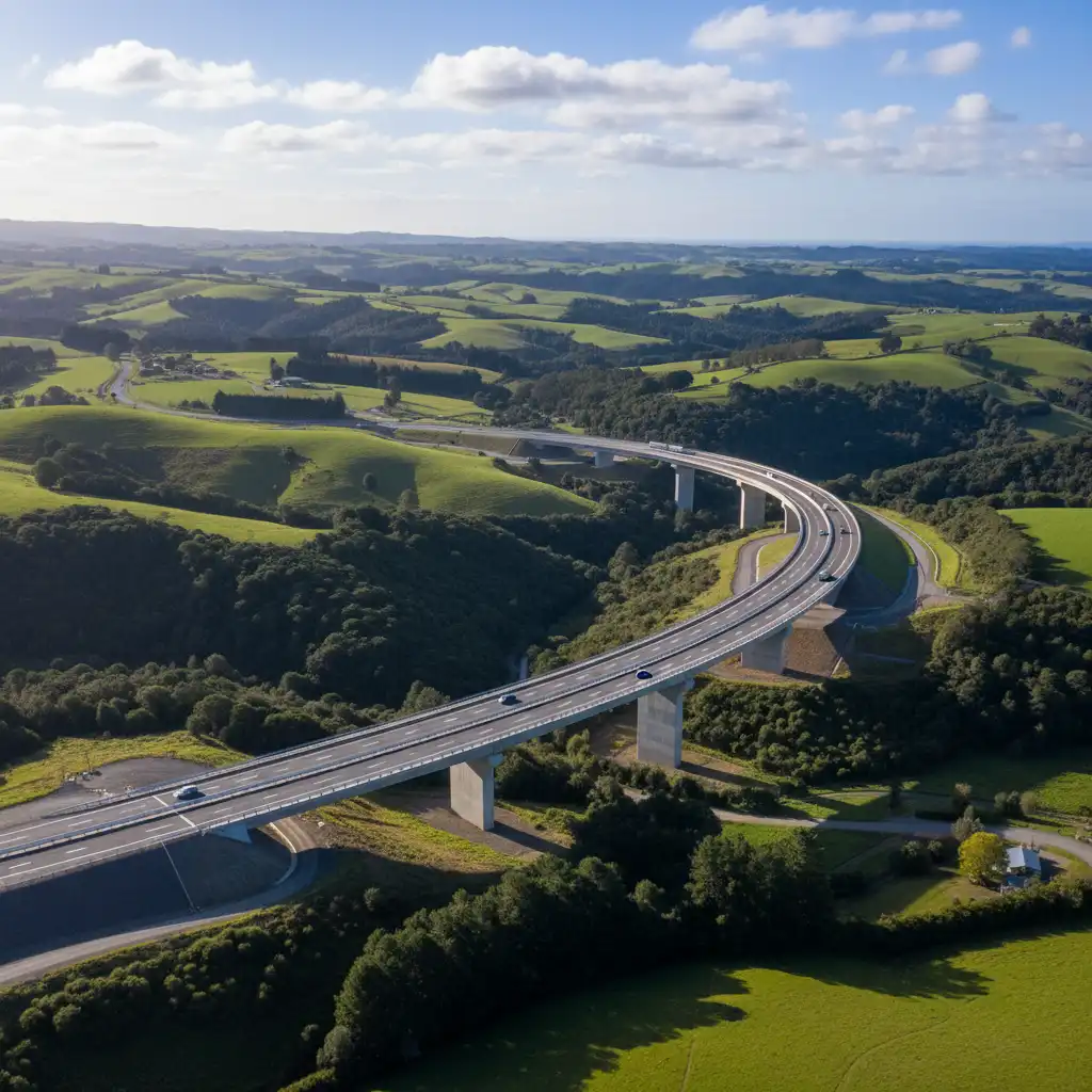
How Has the Ara Tūhono (Pūhoi to Warkworth) Changed Traffic?
The opening of the Ara Tūhono – Pūhoi to Warkworth motorway in 2023 was a game-changer for Northland and Matakana traffic, but it has not eliminated congestion entirely; it has merely shifted it.
Previously, the winding road through the Pūhoi valley was a major safety risk and bottleneck. The new motorway is a sweeping, safe, four-lane highway that drastically improves safety and resilience. However, the motorway terminates at a roundabout north of Warkworth. This means traffic moving towards Matakana must still navigate from the motorway terminus back toward the Hill Street intersection or utilize the new link roads.
Strategic Tip: Use the new motorway to bypass the old Windy Ridge, but be prepared for a queue at the Warkworth exit ramp during peak times. Stay in the correct lane early as you approach the roundabout to ensure you don’t get swept north towards Whangārei if your destination is Matakana.
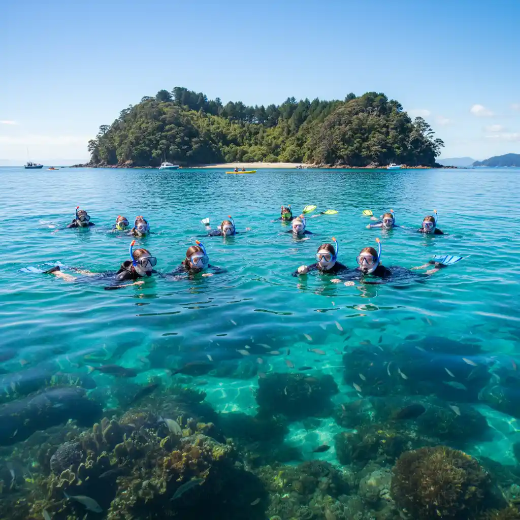
Traffic Considerations for Marine Education & Tourism
For those traveling to the region specifically for marine education purposes, such as school trips to the Goat Island Marine Discovery Centre or diving excursions, strict adherence to schedule is often required due to tidal conditions.
Tides Wait for No Man (or Traffic)
Marine education activities, particularly snorkeling and rocky shore exploration, are heavily dependent on the tides. Missing a low tide window due to traffic can ruin an educational itinerary.
If you are booking a session at the Marine Discovery Centre:
- Buffer Time: Always add a 45-minute buffer to your travel time if traveling on a weekend.
- Early Arrival: Plan to arrive at Goat Island 1 hour before your scheduled activity. The parking at Goat Island is limited and fills up rapidly on sunny days. If you arrive late, you may be turned away or forced to park kilometers up the hill, adding a strenuous walk to your journey.
- Pre-Trip Check: Check the “Matakana Traffic Updates” Facebook groups or NZTA journey planner 2 hours before departure. Accidents on the Dome Valley or near Warkworth can close the road entirely, requiring a complete cancellation of the trip.
People Also Ask
Is there a bypass for Warkworth to get to Matakana?
Currently, there is no direct bypass that completely avoids Warkworth for traffic coming from the south. The Matakana Link Road has improved access, but travelers generally still need to navigate the outskirts of Warkworth. The proposed Warkworth Transport Hub and future roading projects aim to alleviate this, but for now, the link road is your best option to avoid the town center.
What is the best time to drive back to Auckland from Matakana on a Sunday?
The best time to drive back is either very early (before 10:00 AM) or late in the evening (after 7:00 PM). Traffic tends to be heaviest between 12:00 PM and 5:00 PM as day-trippers and weekenders return simultaneously.
How much time does the new motorway save to Matakana?
The Ara Tūhono (Pūhoi to Warkworth) motorway typically saves 10–15 minutes of driving time compared to the old route. However, its primary value is in safety and consistency; it avoids the frequent accidents that used to block the old winding state highway.
Are there toilets on the drive from Auckland to Matakana?
Yes, but they are limited once you are on the new motorway. It is recommended to use facilities at the bp Service Station at the Dairy Flat/Silverdale interchange or in Warkworth town itself. There are no rest stops directly on the new motorway section.
Does Google Maps show the Matakana Link Road?
Yes, Google Maps and Apple Maps have been updated to include the Matakana Link Road. Ensure your app is updated to the latest version to utilize this route, which helps bypass the worst of the Hill Street intersection congestion.
Is the drive to Matakana safe for campervans?
Yes, the drive is generally safe for campervans, especially with the new motorway. However, drivers should exercise caution on Matakana Road and Leigh Road, which can be narrow with deep ditches. The Hill Street intersection requires careful lane positioning for large vehicles.