
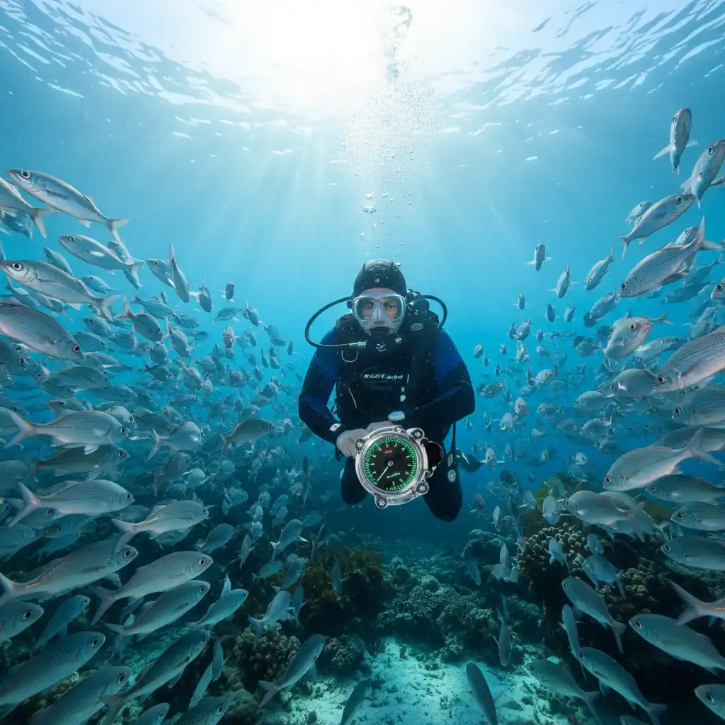
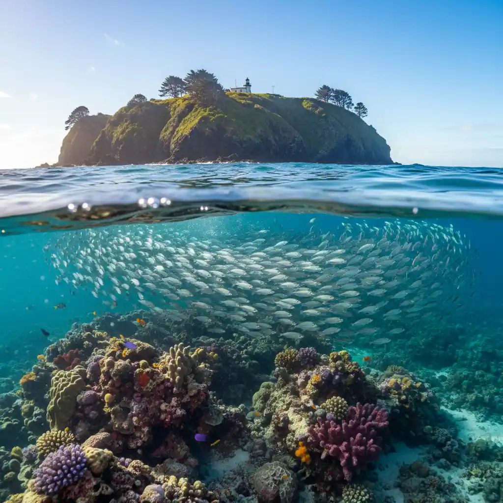
The ideal Goat Island visibility report for snorkeling and diving indicates offshore winds from the South or Southwest and a swell height below 0.5 meters. These conditions suppress sediment suspension, typically resulting in 10 to 20 meters of crystal-clear underwater visibility at the Cape Rodney-Okakari Point Marine Reserve.
Live Webcams and Visibility Reports
Before packing your gear and driving to Leigh, checking real-time data is crucial. Goat Island (Cape Rodney-Okakari Point Marine Reserve) is a dynamic environment where conditions can change rapidly. While historical trends are useful, nothing beats a live update.
Where to Find Accurate Daily Reports
There are several reliable sources for a current Goat Island visibility report. Relying on a single source can sometimes be misleading, so cross-referencing these platforms is the professional standard for dive planning:
- Goat Island Dive & Snorkel: The local dive shop located in Leigh often posts daily updates on their Facebook page or website. Because they have instructors in the water daily, their qualitative reports (e.g., “10m vis, slight chop”) are often more practical than raw meteorological data.
- SwellMap (Marine Forecast): This is the go-to for quantitative data. Look specifically for the “Leigh” or “Goat Island” localized forecast. Pay close attention to the “Rating” (out of 10) for diving conditions.
- Seafriends: While the Seafriends center has closed its physical doors, their legacy of data and periodic updates regarding the marine reserve’s health and conditions remains a cornerstone of local knowledge.
- MetService Marine: Use the recreational marine forecast for the “Auckland East” coast, but refine your interpretation based on the specific geography of Leigh (detailed below).
Best Wind Directions for Clarity
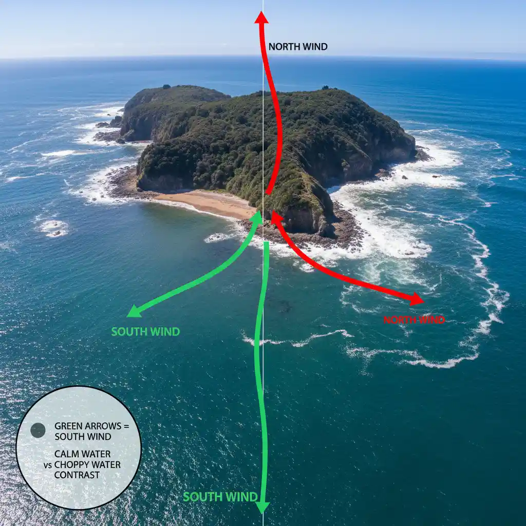
Wind direction is the single most significant variable affecting underwater visibility at Goat Island. Because the reserve is located on the east coast of the Northland peninsula, it is exposed to specific weather patterns that dictate water clarity.
The Golden Rule: Offshore Winds
For the best visibility, you want the wind to be blowing offshore. At Goat Island, this means winds coming from the South or Southwest.
When the wind blows from the land out to sea (Southerlies), it flattens the waves near the shore. This lack of wave action prevents the seabed—composed of sand and rock—from being churned up. When the sediment settles, visibility improves dramatically, often exceeding 15 meters.
The Enemy: Onshore Winds
Conversely, winds from the North, Northeast, or East blow directly onto the beach. These are “onshore” winds. Even a light breeze from the North can generate “chop” (small, frequent waves) that disturbs the shallow water.
When onshore winds persist for more than 12 hours, the visibility usually drops to less than 3 meters. The water becomes milky due to suspended sand and organic matter. If the forecast predicts strong Northerlies (over 15 knots), it is generally advisable to postpone a snorkeling trip if your primary goal is sightseeing.
Understanding Swell Reports
While wind creates local chop, “swell” refers to the energy generated by distant weather systems. Swell can destroy visibility even on a calm, windless day. Understanding the difference between ground swell and wind swell is vital for interpreting a Goat Island visibility report.
Swell Height and Period
Ideal Conditions: Swell height under 0.5 meters with a long period (10+ seconds) or very short period (local wind swell that dies quickly).
Poor Conditions: Swell height over 1.0 meter. Once the swell exceeds one meter, the surge underwater becomes powerful. This surge acts like a washing machine, lifting heavy particles from the bottom and keeping them suspended in the water column.
The “washing machine” Effect
Goat Island creates a channel between itself and the mainland beach. When a significant Easterly swell hits, the water is funneled through this channel. This accelerates the water movement, drastically reducing visibility. If you see a swell forecast of 1.5m+ from the East, visibility will likely be near zero, and snorkeling may be dangerous due to currents.
Seasonal Visibility Trends
The marine environment at Leigh changes drastically throughout the year. A visibility report in January looks very different from one in July due to biological and meteorological factors.
Summer (December – February)
Visibility: Variable (5m – 10m).
Summer brings warmer water (20°C – 22°C), which attracts huge crowds. However, warmer water promotes plankton blooms. These microscopic organisms can turn the water green and hazy, reducing visibility. While the fish life is abundant, the “crystal clear” days are less frequent than in winter. Furthermore, summer cyclones or tropical depressions can bring prolonged periods of northerly winds.
Autumn (March – May)
Visibility: Excellent (10m – 15m).
This is often the “sweet spot” for divers. The water retains some summer warmth, but the equinox winds often settle, and plankton blooms die off. You can experience some of the best days of the year during April and May, provided there are no late-season storms.
Winter (June – August)
Visibility: Superior (15m – 25m).
If you can brave the cold (water drops to 13°C – 15°C), winter offers the clearest water. The prevailing wind flow in New Zealand during winter is often from the Southwest (offshore at Leigh), which flattens the sea. Additionally, cold water holds less suspended organic matter. Photography enthusiasts prefer winter for this reason.

Spring (September – November)
Visibility: Unpredictable (2m – 15m).
Spring is known for strong westerly winds. While westerlies are generally offshore (good), they can be gusty and unpredictable. Spring also marks the beginning of new plankton cycles, which can lead to sudden drops in clarity overnight.
How to Read a Marine Forecast for Leigh
To accurately predict the Goat Island visibility report before it is published, you need to learn to synthesize data from multiple points. Here is a step-by-step guide to reading the marine forecast specifically for this location.
1. Check the Isobars
Look at a synoptic weather map. If the isobars (lines of pressure) are close together, it means strong winds. If the flow is coming from the bottom of New Zealand upwards towards Leigh, it is likely a Southerly (Good). If the flow is coming from the tropics down, it is a Northerly (Bad).
2. Analyze the “Fetch”
Fetch is the distance wind has traveled over open water to create waves.
Limited Fetch (Good): When the wind comes from the land (Southwest), it has zero fetch to build waves before it hits the water at Goat Island beach. The water stays flat.
Long Fetch (Bad): When wind comes from the Northeast, it has traveled across the entire Pacific Ocean, building energy that unloads on the beach.
3. The Rain Factor
Heavy rainfall affects visibility, but not immediately. Leigh is surrounded by some hills and runoff areas. If it has rained heavily for 24 hours, runoff from the land can dirty the water, particularly in the shallows. However, this usually clears within a tide cycle or two unless the rain was torrential.
The Impact of Tides and Depth
Timing your visit with the tides can improve your experience by 20-30% regarding clarity.
High Tide vs. Low Tide
High Tide is Superior: At high tide, fresh, clean oceanic water floods the reserve. This dilutes the sediment near the shore.
Low Tide Issues: At low tide, the water is shallower, meaning any wave action stirs up the bottom more easily. Additionally, you are forced to enter the water further out over slippery rocks, and the concentration of sand particles in the water column is higher.
Recommendation: Aim to be in the water 1 hour before high tide. This gives you the clearest water and the easiest entry/exit conditions.
Depth and Stratification
Sometimes, the surface looks murky, but the bottom is clear. This is often due to a freshwater layer (from rain) sitting on top of the denser saltwater. If you are a diver, you might find that dropping below 5 meters gets you underneath the “halocline” (salt gradient) or thermocline, where visibility improves significantly.
What to Do When Visibility is Poor
Sometimes, despite your best planning, the Goat Island visibility report turns grim upon arrival. The ocean is unpredictable. If you arrive and find the water is “soup,” here are your best alternatives in the area:
- Goat Island Marine Discovery Centre: Located just up the hill from the beach, this education center is world-class. It features touch tanks, microscopes, and detailed history of the reserve. It is an excellent educational alternative for families.
- The Coastal Walkway: The walk from Goat Island to Cape Rodney offers stunning views. Even if the water is messy, the raw power of the ocean crashing against the cliffs is a spectacle in itself.
- Matheson Bay: Located nearby in Leigh, Matheson Bay is sometimes more sheltered than Goat Island depending on the specific angle of the wind. It has a sandy beach and is safe for swimming, though it is not a marine reserve, so fish life is less prolific.
- Glass Bottom Boat: If the visibility is marginal (3-5m), the Glass Bottom Boat is often a better option than snorkeling. The boat tours know exactly where the fish congregate, and looking through the glass eliminates the surface chop and light refraction issues that snorkelers face.
Frequently Asked Questions
What is the best month to visit Goat Island for clear water?
The best months for water clarity are typically during the winter (June to August) or late Autumn (May). During these times, the prevailing offshore winds flatten the sea, and reduced plankton levels result in visibility that can exceed 20 meters, although the water is significantly colder.
Can I snorkel at Goat Island when it is raining?
Yes, you can snorkel when it is raining. Rain itself does not immediately ruin underwater visibility. However, heavy rain over several days can cause runoff from the land, which may cloud the shallow waters. Light rain has negligible impact on clarity.
How do I check the live swell for Goat Island?
The most accurate way to check live swell is via the SwellMap website or app, selecting the “Leigh” or “Goat Island” forecast. Look for a swell height of under 0.5 meters and a wind direction from the South or Southwest for the best conditions.
Why is the visibility sometimes poor even when it is sunny?
Sunlight does not equal clarity. Visibility is primarily determined by sediment suspension caused by wind and swell. A sunny day with strong Northerly winds will result in poor visibility because the onshore waves churn up the sandy bottom.
Is high tide or low tide better for snorkeling Goat Island?
High tide is significantly better for snorkeling. The influx of clean ocean water improves visibility, and it is much easier to enter and exit the water over the rocky shoreline when the tide is high.
What is the average water temperature at Goat Island?
Water temperature peaks at around 22°C (72°F) in February and drops to a low of approximately 13°C (55°F) in August. A 3mm wetsuit is recommended in summer, while a 7mm wetsuit with a hood is standard for winter diving.