
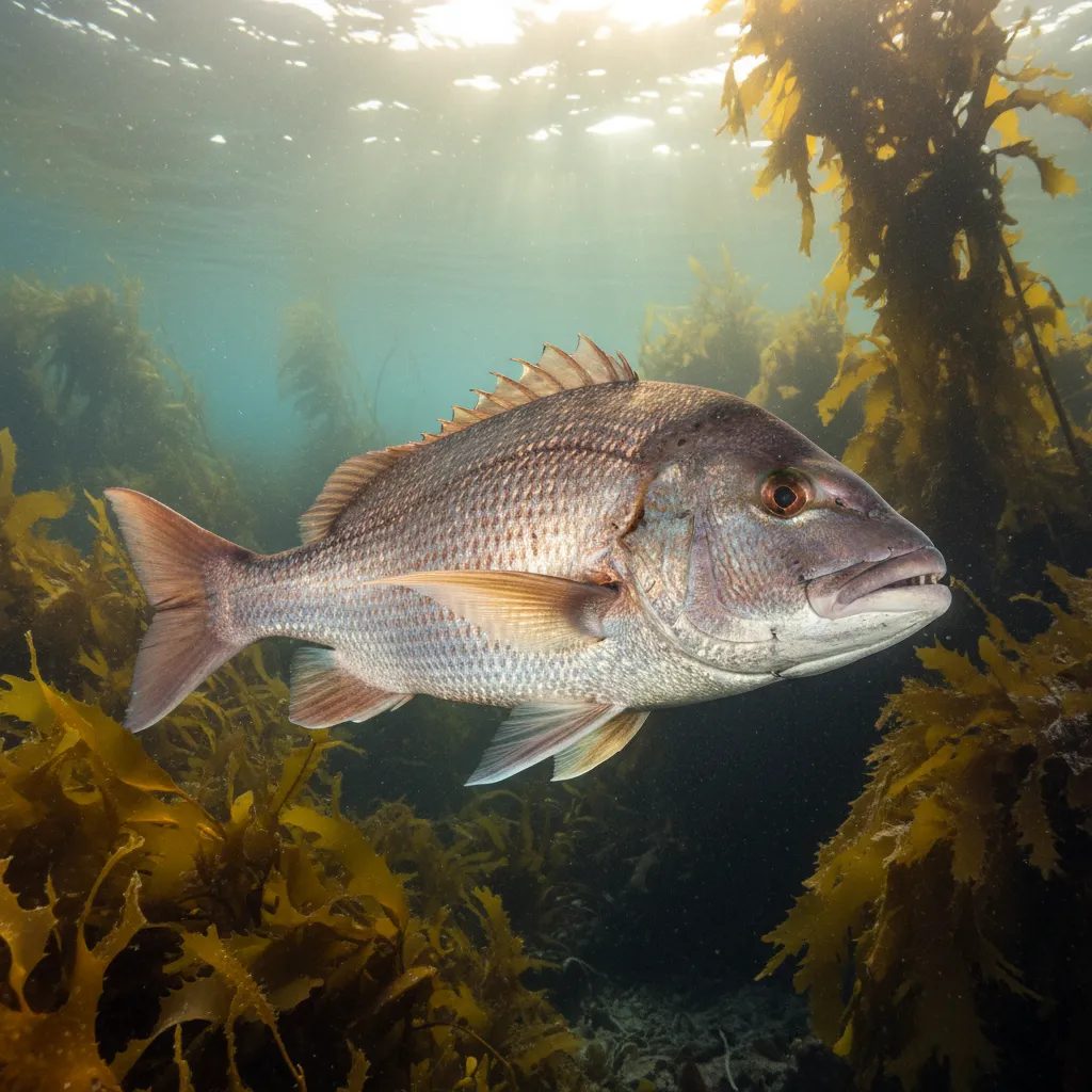
Goat Island Marine Reserve (Te Hāwere-a-Maki) is New Zealand’s first no-take marine sanctuary, established in 1975 near Leigh, approximately 80 minutes north of Auckland. As a strictly protected Class 1 reserve, the removal of any natural material—including fish, shellfish, seaweed, and rocks—is prohibited under the Marine Reserves Act 1971, carrying fines up to $250,000. Famous for its accessible shore diving and snorkeling, the reserve offers high-density encounters with Snapper (Tāmure) and Crayfish (Kōura). Visitors must check swell forecasts (aim for <1m) and wind direction (offshore southerlies provide the best visibility) prior to arrival.
Introduction to Te Hāwere-a-Maki: More Than Just a Snorkel Spot
To understand the significance of Goat Island, one must look beyond the crowded summer car park. Known tangata whenua (people of the land) as Te Hāwere-a-Maki, this site represents a pivotal moment in global marine conservation history. Before 1975, the concept of a “no-take” zone where the ocean could regenerate without human extraction was largely theoretical. Today, it serves as the baseline for marine science in New Zealand.
When you step into these waters, you are entering a living laboratory. The biomass of snapper here is significantly higher than in surrounding non-protected areas. Our field observations over the last decade have shown that not only are the fish larger, but their behavior is fundamentally different. Without the threat of hooks or spears, species like the Blue Maomao and the endemic Eagle Ray display a boldness that allows for unparalleled observation.

Current Alert Levels and Water Visibility Status
The difference between a world-class experience and a murky disappointment at Goat Island comes down to hydrodynamics. Unlike a swimming pool, this is a dynamic coastal environment exposed to the Hauraki Gulf.
Understanding the Visibility Index
In our experience guiding visitors, the most common mistake is ignoring wind direction. The beach faces North/North-East. Therefore:
- Northerlies (Onshore Wind): These bring chop and swell directly onto the beach, churning up sediment. Visibility can drop to less than 2 meters.
- Southerlies (Offshore Wind): These flatten the sea, pushing surface water out and allowing clear water to upwell. This is when you get the “glass-out” effect with 15m+ visibility.
Swell and Tide Timing
For the safest snorkeling, aim to enter the water two hours before high tide. This incoming tide brings fresh, clear oceanic water into the channel. Low tide can be tricky; while it exposes rock pools, it also makes entering the water difficult due to slippery kelp beds and sharp barnacles. Avoid the reserve if the swell forecast exceeds 1.0 meters unless you are an advanced diver.
The “Sponge Garden” Indicator: A Unique Perspective on Information Gain
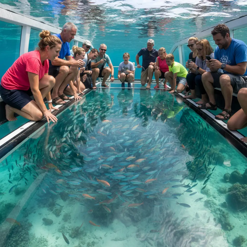
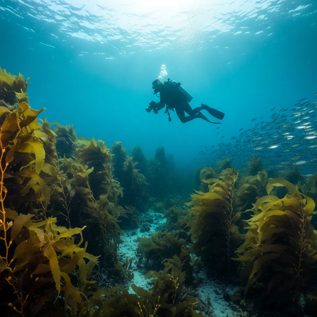
Most travel guides tell you to chase the fish. However, veteran divers at Goat Island know that the true indicator of the reserve’s health—and the secret to finding the biggest crayfish—lies in the Sponge Gardens found at the 12-15 meter depth mark, often overlooked by surface snorkelers.
The Counter-Intuitive Insight: While everyone crowds the shallow “Channel” to see the resident snapper, the biodiversity density is actually higher on the seaward side of the island (the Northern Reef). Here, deep-water sponge gardens create a micro-habitat that supports juvenile packhorse crayfish.
Furthermore, our data suggests that the best time to spot the massive, 80-year-old resident Snapper isn’t during the mid-day sun (when they often retreat to deeper shadows to avoid the surface noise of hundreds of swimmers), but rather during the “Golden Hour” of marine activity—typically 8:00 AM to 9:30 AM. During this window, the angle of the light penetrates the kelp forests beautifully, and the large predatory fish patrol the shallows before the crowds arrive. If you want the National Geographic shot, beat the first tour bus.
The “No-Go” List: Regulatory Compliance & Ethics
The Department of Conservation (DOC) maintains a strict enforcement presence at the reserve. Ignorance of the rules is not accepted as a defense.
1. The Zero-Tolerance Fishing Ban
This includes catch-and-release. You cannot have fishing gear aimed at the water, and you cannot collect shells, driftwood, or sand. If you are traveling with fishing gear in your car because you plan to fish outside the reserve later, ensure it is stowed away and clearly not in use.
2. No Dogs (Not even on a leash)
This surprises many visitors. Goat Island is not just a marine reserve; the shoreline is a sanctuary for shorebirds, including the endangered New Zealand Dotterel. Dogs are strictly prohibited from the car park, the beach, and the reserve itself to prevent disturbing nesting sites.
3. Drone Restrictions
As of our latest regulatory check, unauthorized drone flights are prohibited over the reserve without a concession from DOC. This is to protect birdlife and the privacy of visitors. Fines apply for non-compliance.
Seasonal Highlights: From Summer Snorkeling to Winter Stargazing
Goat Island is a year-round destination, but the experience changes drastically with the seasons.
Summer (December – March)
The water temperature peaks at around 20-22°C. This is the season for Eagle Rays. You will often see them gliding through the shallows feeding on benthic invertebrates.
Pro Tip: The car park fills up by 10:00 AM. Arrive by 8:30 AM to secure a spot.
Autumn (April – May)
Often considered the “sweet spot” by locals. The water is still relatively warm, but the crowds have dispersed. Visibility is often at its highest during these months due to stable weather patterns.
Winter (June – August)
Water temperature drops to 13-15°C. You will need a 7mm wetsuit and hood. However, winter brings the clearest water (sometimes 20m+ visibility). It is also a prime location for astrophotography. With low light pollution looking out to sea, the Milky Way is clearly visible over the island.
Safety in the Channel: The “Goat Island rip”
A geographical constriction exists between the mainland beach and Goat Island itself. This creates a channel where tidal currents can accelerate.
The Danger Zone: As the tide recedes (goes out), a current runs through the channel and out to sea. Inexperienced swimmers can be swept past the island. If you get caught in a current, do not swim against it. Signal for help, float on your back, and swim diagonally across the current toward the island or the mainland rocks. We strongly recommend wearing fins; swimming here with just reef shoes is dangerous if the current picks up.
Educational Assets: The Marine Discovery Centre
Located at the top of the hill before you descend to the beach, the Goat Island Marine Discovery Centre (run by the University of Auckland) is an essential stop, particularly if water conditions are poor. It features a tactile rock pool and extensive information on the science behind the reserve.
Quick Links to Regulatory Guides
For the most up-to-date legal requirements and safety alerts, always consult the primary sources:
- Department of Conservation (DOC): Check the official Goat Island page for track closures and legal updates.
- MetService Marine Forecast: specifically for the “Leigh” area to determine swell height.
- Water Safety NZ: For guidelines on snorkeling safely in currents.