The Cape Rodney-Okakari Point Marine Reserve, commonly known as Goat Island, is a strictly protected no-take zone where all fishing and gathering is prohibited. The fishing boundary extends 800 meters seaward from the high-water mark between Cape Rodney and Okakari Point, marked by large triangular beacons on the shore. Anglers must remain outside this perimeter to fish legally.
Understanding the exact boundaries of the Goat Island Marine Reserve is critical for any skipper, angler, or diver visiting the Hauraki Gulf. As New Zealand’s first marine reserve, established in 1975, it serves as a benchmark for marine conservation. However, the strict “no-take” policy means that navigating the perimeter incorrectly can result in severe legal consequences, including the seizure of vessels and fishing gear. This guide provides the essential navigational data, visual references, and technological tools required to enjoy the area responsibly while ensuring you stay on the right side of the law.
Identifying the Marine Reserve Boundaries
The Cape Rodney-Okakari Point Marine Reserve covers approximately 518 hectares of coastal sea. For recreational fishermen targeting snapper or kingfish near the reserve, precision is key. The reserve is not merely a line on a map; it is a legally enforced zone where the Marine Reserves Act 1971 applies in full force. The area spans the coastline from Cape Rodney in the north to Okakari Point in the south, extending 800 meters (approximately 0.43 nautical miles) out from the Mean High Water Mark.
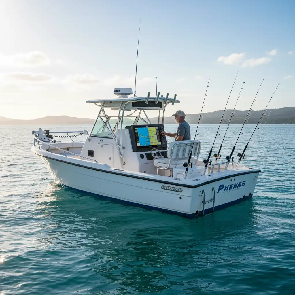
Many anglers search for a “Goat Island marine reserve map fishing” guide because the area immediately outside the reserve is often teeming with spillover fish. Large snapper and crayfish often migrate across the invisible line, making the perimeter a hotspot for fishing. However, fishing right on the line is risky. Department of Conservation (DOC) rangers patrol this area frequently, often using high-powered optics to verify a vessel’s position relative to the shore markers.

GPS Coordinates for the Boundary
For modern vessels equipped with chart plotters and GPS, digital navigation is the safest way to ensure compliance. Relying solely on visual estimation can be deceptive, especially when wind and current affect your drift. Below are the key reference points defining the seaward boundary of the reserve.
Key Waypoints
While official hydrographic charts (such as NZ 522) should always be the primary source for navigation, the reserve is generally defined by the area between:
- Northern Limit (Cape Rodney): Approximately 36° 16.8′ S latitude.
- Southern Limit (Okakari Point): Approximately 36° 18.2′ S latitude.
- Seaward Limit: 800 meters from the Mean High Water Mark along this stretch of coast.
Setting Up Your Chart Plotter
Most modern multifunction displays (MFDs) from brands like Simrad, Garmin, and Raymarine have electronic charts that display marine reserve layers. However, skippers should verify that their chart cards are updated. An outdated chart might not show the precise boundary line. It is best practice to set a proximity alarm or a waypoint line slightly outside the 800-meter mark—perhaps at 900 or 1000 meters—to create a safety buffer. This accounts for GPS error margins and unexpected anchor drag.
Visual Landmarks for Boaties
Electronics can fail, and GPS signals can occasionally drift. Therefore, every skipper must know how to identify the reserve boundaries using physical shore markers. The Department of Conservation has installed specific triangular markers to help boaties align their position.
The Triangle System
At both the northern and southern limits of the reserve (Cape Rodney and Okakari Point), you will find large triangular beacons erected on the cliffs or prominent foreshore areas. These are designed to be highly visible from the water.
- The Markers: These are typically large yellow and white triangles.
- Sighting the Line: When you are at the limit of the reserve (north or south), the two triangles at that location will line up vertically or horizontally (depending on the specific installation design for that site).
- The 800m Rule: The triangles mark the lateral boundaries along the coast. Judging the 800-meter distance seaward is more difficult visually. A good rule of thumb is that if you can clearly distinguish people walking on the beach or rocks without binoculars, you are likely too close to be fishing.

Goat Island Itself
Goat Island (Te Hāwere-a-Maki) sits within the reserve. The island acts as a central landmark. If you are fishing anywhere between the island and the mainland, you are deep inside the reserve and breaking the law. If you are fishing on the seaward side of the island, you must ensure you are well beyond the 800-meter buffer from the island’s own high-water mark as well as the mainland coast.
Fishing Rules and Buffer Zones
The primary intent of the user search “Goat Island marine reserve map fishing” is often to find where they can fish. It is vital to understand that the rules inside the reserve are absolute.
What is Prohibited?
Inside the boundaries, you cannot:
- Fish: This includes line fishing, spearfishing, netting, and potting.
- Gather: Taking crayfish, shellfish, seaweed, or even rocks and shells is illegal.
- Disturb: Feeding fish is also prohibited as it alters their natural behavior.
Fishing the Boundary (The “Line”)
Fishing immediately outside the boundary is legal, but it requires extreme caution. If you hook a fish outside the reserve, but the fish swims into the reserve and you fight it there, you are technically in a grey area that could lead to prosecution if your vessel drifts across the line during the fight. Furthermore, if you are drift fishing, you must account for the current. If you drop your line outside the reserve but drift inside while the line is in the water, you are fishing illegally.
Recommendation: Maintain a buffer zone of at least 100-200 meters from the boundary. This protects you from accidental infringement and respects the conservation efforts that make the surrounding fishery so productive.
The Consequences of Drifting Inside
New Zealand takes its marine biosecurity and conservation laws seriously. The penalties for fishing inside a marine reserve are not merely a “slap on the wrist.” They are designed to be a significant deterrent.
Legal Penalties
Under the Marine Reserves Act 1971, penalties for taking marine life from a reserve can include:
- Fines: Convictions can lead to fines of up to $10,000 or more depending on the severity and commercial nature of the offense.
- Imprisonment: In extreme cases, up to three months in prison.
- Confiscation: This is the most immediate risk for recreational boaties. Rangers and fishery officers have the power to seize all fishing gear used in the offense. More importantly, they can seize the vessel itself, along with any trailer or vehicle used to transport the vessel.
Strict Liability
Marine reserve offenses are generally “strict liability” offenses. This means that claiming “I didn’t know I was inside” or “My GPS was wrong” is not a valid legal defense. As the skipper, it is your absolute responsibility to know your position at all times.
Using the MarineMate App
One of the best tools for avoiding accidental infringement is the MarineMate app. This smartphone application is specifically designed for New Zealand waters and aggregates data from regional councils, the Department of Conservation, and Maritime NZ.
How to Use MarineMate for Goat Island
- Download and Install: Available for both iOS and Android.
- Location Services: Ensure your phone’s GPS location services are enabled.
- Map View: Open the map interface. Marine reserves are typically highlighted in distinct colors (often purple or red).
- Real-Time Tracking: The app shows your current position relative to the reserve boundary. It helps you visualize exactly where the 800-meter line sits relative to your boat.
While MarineMate is an excellent tool, never rely on a smartphone as your sole means of navigation. Batteries die, screens overheat in the sun, and GPS chips in phones are generally less accurate than dedicated marine chart plotters.
Why the Boundaries Matter
Respecting the Goat Island marine reserve map boundaries ensures the longevity of the ecosystem. Since its establishment, the reserve has seen a massive recovery in snapper and crayfish populations. Large snapper, which are rare in heavily fished areas, are common here. These large fish are prolific breeders; a single large snapper produces as many eggs as dozens of smaller ones.
The “spillover effect” is real. By respecting the sanctuary, anglers contribute to a system where the excess fish migrate out of the reserve to repopulate the surrounding Hauraki Gulf. When you adhere to the boundaries, you aren’t just following the law; you are investing in the future of New Zealand fishing.

Frequently Asked Questions
Can I anchor inside the Goat Island Marine Reserve?
Yes, you are generally allowed to anchor inside the reserve for resting, swimming, or diving, provided you have no intention of fishing. However, you must ensure your anchor does not damage fragile reefs. If you have fishing gear on board, it must be stowed away securely to prove you are not actively fishing.
Is shore fishing allowed at Goat Island?
No. Shore fishing is strictly prohibited within the reserve boundaries, which includes the beaches and rocks from Cape Rodney to Okakari Point. You must move along the coast outside the marked boundaries to fish from the shore.
How far out does the Goat Island Marine Reserve extend?
The reserve extends 800 meters (approx. 875 yards) seaward from the Mean High Water Mark along the designated coastline. Beyond this 800-meter buffer, standard fishing regulations apply.
Can I carry fishing gear on my boat while transiting the reserve?
Yes, you can transit through the reserve with fishing gear on board. However, the gear should be stowed, and you should not stop the vessel in a manner that suggests you are fishing. If stopped by a ranger, you must demonstrate that you are only transiting.
Are there cameras monitoring the marine reserve?
Yes, surveillance is active in the area. Land-based rangers often use high-powered spotting scopes, and there is increasing use of technology to monitor vessel movements within the reserve boundaries.
Where is the best place to fish near Goat Island?
The area immediately outside the 800-meter boundary, particularly over the sand-mud interface or deeper reef structures further out in the Gulf (like near Little Barrier Island), is popular. Drifting just outside the boundary line (accounting for wind/current) can yield fish moving out of the reserve.